Publications
Cartography
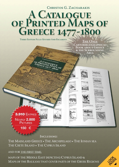
A Catalogue of Printed Maps of Greece 1477-1800
Author: Christos G. Zacharakis
Editor: Artemis Scutari
Language: English
Athens, 2009 (3rd edition)
Author: Christos G. Zacharakis
Editor: Artemis Scutari
Language: English
Athens, 2009 (3rd edition)
3rd edition (Athens 2009), fully revised and enlarged, with 3.910 entries and 2.000 pictures. The only cartobibliographical book about Greece and the surrounding area. It features Mainland Greece, the Archipelago, the Ionian Sea, Crete and Cyprus with its surrounding area. Maps of the Middle East depicting Cyprus and maps of the Balkans including parts of the Greek regions are also being presented for the first time.
Hardcover, 34 x 25 cm, 358 pages
ISBN: 978-960-87792-4-2
Published by AdVenture SA